Stock
Foto
Collections
Lightboxes
Impresiones y productos
Wall Art
Canvas Prints
Framed Prints
Prints and Posters
Metal Prints
Acrylic Prints
Categorías
Prueba
Prueba2
Información de la web
Sobre nosotros
Soporte
Política de privacidad
FAQ
Contactar
Google map
Carrito
Área del cliente
Español
El carrito está vacío.
Total:
View cart
Realizar pedido
Inicio
Catálogo
Descargar muestra
Detalles del fichero
Publicado:
2022-02-08 20:18:33.104514
Categoría:
Technology
Tipo:
Foto
Model release:
No
Share
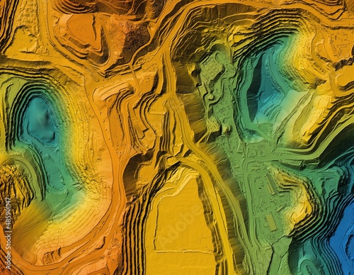
Digital elevation model. GIS product made after proccesing aerial pictures. It shows excavation site with steep rock walls that was mapped from a drone
Contributor:
Ungrim
ID : 485901147
Archivos
Impresiones y productos
Título
filesize
Foto
6577x5106
Buy on Adobe Stock
Título
Precio
Comprar
Wall Art
Canvas Prints
€30.00
Framed Prints
€10.00
Prints and Posters
€5.00
Metal Prints
€10.00
Acrylic Prints
€10.00
Order print
Palabras clave
quarry
,
cartography
,
us
,
us
,
excavate
,
construction
,
engineer
,
development
,
drone
,
elevation
,
excavation
,
engineering
,
shoveling
,
geodesy
,
geology
,
graphic
,
hole
,
industrial
,
industry
,
inspection
,
investigation
,
land
,
map
,
mine
,
model
,
topography
,
terrain
,
professional
,
rock
,
site
,
survey
,
surveying
,
technology
,
topographic
,
transportation
Elementos relacionados